
Environment Canada Issues Snowfall Alerts for Interior Routes
Environment Canada has put out snowfall warnings for parts of the British Columbia Interior, including the Coquihalla Highway and sections of the Trans-Canada Highway, as a strong frontal system moves through the region. The forecast warns of several days of accumulating snow, gusty winds and potentially dangerous travel conditions across mountain passes and valley routes.
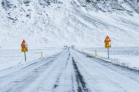
Heavy Snow Expected, Especially on Coquihalla Highway
Between 40 and 60 centimetres of snow is expected to fall between Wednesday, Feb. 25 and Friday, Feb. 27 along the Coquihalla Highway stretch between Hope and Merritt, according to the yellow-level snowfall warning — the most common dangerous weather alert issued by Environment Canada. That amount of snow over a short period could make roads slippery and reduce visibility, posing a risk for motorists and commercial traffic alike.
Officials say a strong frontal system moving through the region is responsible for both persistent snowfall and high winds, which can create unstable conditions on highways and at higher elevations.
Warnings Extend Beyond Just One Highway
The snowfall warning isn’t limited to just the Coquihalla. Sections of Highway 1 from Eagle Pass to Rogers Pass are also under alert, with forecasts suggesting 20-25 cm of snow could fall through Thursday. Snow and windy conditions are also expected across parts of the Fraser Canyon, the Stuart-Nechako region and even the southern Peace region, where snow squall warnings may further lower visibility at times for drivers.
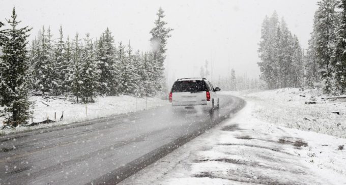
Prepare for Changing Conditions
Environment Canada emphasizes that mountain weather can change quickly, turning what looks like a manageable road into a treacherous one in a matter of hours. Drivers are advised to check travel conditions before departure, carry winter safety gear, and be ready for sudden snowfall or wind-driven blowing snow as the storm moves through.
With heavy snow forecast across key travel corridors in the Interior, residents and travellers should allow extra time, adjust plans if necessary, and take all safety warnings seriously over the next several days.
Stay updated instantly — follow us on Instagram | Facebook | X


